3D point cloud annotation is transforming how robots understand the world, and it starts with a simple shift: from two dimensions to three. In other words, robots are getting smarter, and the data behind that intelligence is becoming three-dimensional (3D). Images and videos are two-dimensional (2D), and when used to train AI models for robots, they capture how the world looks but not how it actually exists in space.
A robot trained on 2D data can see objects, but doesn’t have a reliable sense of depth, distance, orientation, or physical structure. Without that spatial understanding, even straightforward tasks become difficult. Navigating a warehouse, grasping a tool, or positioning a robotic arm all depend on knowing where things exist in space.
That spatial understanding can come from 3D point clouds, and they are changing what robots are capable of. Unlike 2D images, point clouds provide a full three-dimensional representation of an environment, showing where objects are located, how far away they are, and the physical space they occupy.

An Example of a 3D Point Cloud Scan of a Street (Source: Daniel L. Lu, Wikimedia Commons)
When this data is accurately annotated, it gives robots the spatial intelligence they need to interact with the real world confidently and precisely. You can think of it like this: raw point cloud data is just a collection of millions of spatial points. For a robot to recognize roads, shelves, machinery, pedestrians, or graspable objects, that data needs to be labeled and organized first.
That’s exactly what 3D point cloud data annotation does, turning raw sensor output into the structured training data robots need to understand and navigate the world. Let’s dive into what 3D point clouds are, how 3D point cloud annotation works, and why it’s becoming essential for cutting-edge robotics.
Before we explore what 3D point cloud annotation is, let’s take a closer look at 3D point clouds.
A 3D point cloud is a collection of data points positioned in three-dimensional space. Each point represents a precise location on the surface of a real-world object or environment. When combined, these points create a digital spatial map that machines can use to understand and navigate physical surroundings.
Point clouds are typically generated using sensors such as Light Detection and Ranging (LiDAR), depth cameras, stereo vision systems, and structured light scanners. They measure the distance between the sensor and nearby surfaces, producing highly detailed spatial information. This data can be related to objects, terrain, buildings, or movement in an environment.
For example, a self-driving car can use LiDAR to continuously scan roads, vehicles, pedestrians, and obstacles around it. The resulting point cloud helps the system estimate distances, detect object boundaries, and operate safely in real time.
The main difference between images and point clouds is the type of information they capture. Images primarily record appearance, while point clouds capture geometry and spatial position.

The Difference Between 2D Images and 3D Point Clouds (Source)
While a camera image may show that a chair exists, a point cloud reveals its exact dimensions, orientation, and distance from surrounding objects. This spatial understanding is what enables robots and autonomous systems to interact with complex real-world environments accurately and safely.
Data annotation is the process of labeling raw data so AI models can learn to recognize and interpret it. With 3D point clouds, this means identifying and tagging groups of spatial points to represent real-world objects and surfaces such as walls, floors, vehicles, machinery, and people.
A raw point cloud contains only coordinates and spatial measurements. While that information can be used to accurately map the physical world, it doesn’t automatically tell a robot which points belong to a wall, pedestrian, shelf, vehicle, or machine. Annotation adds this meaning by attaching text labels and object information to specific groups of points.
Consider an autonomous mobile robot with LiDAR sensors operating in a warehouse. At any given moment, it can capture millions of 3D points representing racks, boxes, workers, forklifts, and pathways.
Through 3D point cloud annotation, those points can be labeled and organized into identifiable objects and mapped regions. This annotated data can then be used to train the AI model powering the robot, teaching it to recognize objects, understand its surroundings, and make real-time decisions around obstacle avoidance, path planning, and object handling.
Recent robotics research backs this up. Studies have shown that robots using point cloud-based perception can distinguish real objects from flat images, adapt to varying object heights, and perform tasks like picking and packing items from moving conveyor belts more accurately.
Annotating a 3D point cloud isn’t a one-size-fits-all process. There are several 3D point cloud annotation methods, each designed to deliver a different level of spatial understanding depending on the application.
In robotics, the method chosen plays a big role in how well a robot perceives and interacts with its environment. Let’s break down the most widely used ones.
3D bounding boxes are one of the most widely used annotation methods in point cloud labeling.
A 3D bounding box is a rectangular cuboid placed around an object in three-dimensional space, defining its length, width, height, position, and rotation angle across all three axes. This gives AI models a precise spatial footprint of each object, rather than just a flat outline.
Annotators place these boxes around objects such as vehicles, pallets, machinery, and pedestrians, allowing AI systems to learn how to detect, classify, and track them in real-world environments.

A Look at 3D Bounding Boxes Used to Annotate Vehicles in LiDAR Data (Source)
Unlike 2D image boxes, 3D bounding boxes capture depth, size, and orientation in physical space, giving robots a much more accurate picture of their surroundings. An autonomous forklift, for example, can determine where a pallet is located and its exact dimensions, orientation, and whether there is enough clearance to safely pick it up or move around it.
Semantic segmentation takes a more detailed approach to 3D point cloud annotation. Rather than drawing boxes around individual objects, every single point in the point cloud is labeled based on the category it belongs to, such as floor, wall, road, machine, vegetation, or person. All points that belong to the same category receive the same label, creating a complete class-level map of the environment.

Semantic Segmentation of a 3D Point Cloud (Source)
It gives AI models a full understanding of an entire scene rather than just the objects within it. Instead of knowing that a shelf exists, a robot understands the complete layout of its environment, where the floor ends, where the walls are, and which regions are safe to move through.
A scene-level understanding makes it possible for robots to move through spaces more confidently, build accurate maps, and interpret complex real-world environments with much greater precision.
Instance segmentation builds on semantic segmentation by distinguishing each individual instance of different objects within the same category. For example, instead of labeling all nearby trees as “tree,” the annotation identifies each tree or plant individually.

Instance Vs. Semantic Segmentation of a 3D Point Cloud (Source)
This is important in robotics applications where systems have to track, avoid, or interact with multiple moving objects at the same time. Imagine a robotic arm on an assembly line working alongside multiple components of the same type. With instance segmentation, it knows which specific part to pick up next.
Here’s a closer look at how raw spatial sensor data gets transformed into structured training data that robots and AI systems can learn from:
Now that we have covered what 3D point cloud annotation is and how it works, you might be wondering why it matters so much for robotics specifically. The answer comes down to how robots operate.
Unlike a screen or a camera, a robot has to physically exist in and move through the world. And for that, seeing isn’t enough.
2D annotation teaches robots what to see. 3D point cloud annotation teaches them how to act in space. Those are two very different things, and that distinction is what makes 3D annotation so critical for robotics.
A robot needs to do more than recognize a box. It needs to know how far away it is, which side to approach, and how far to extend its arm to pick it up.
Without that spatial layer, a robot can perceive its environment but struggle to interact with it reliably. Perception without spatial context means a machine can’t operate in the physical world.
Let’s say you are working with a warehouse robot. A 2D labeled image can tell it that a pallet is nearby, but it can’t tell it how far away that pallet is, what angle it’s facing, or whether there is enough clearance to approach it safely. A robot relying on just that information may misposition its arm, misjudge the approach, or collide with surrounding obstacles.
3D point cloud annotation fills that gap by giving the robot precise depth, orientation, and geometry for every object in its environment. Spatial intelligence is what enables it to navigate aisles, avoid collisions, and interact with objects accurately, turning a robot that sees into a robot that acts.

A 3D Spatial Map of a Warehouse Environment Used for Robot Navigation (Source)
Many next-generation robotics systems rely on 3D point cloud annotation to perform different tasks across various industries. Here are a few real-world examples of how it’s being used:
Despite advances in sensor technology and 3D point cloud annotation tools, annotating 3D point cloud data for robotics is still a complex and demanding process. The real world is messy, and the data it produces reflects that.
Real-world sensor data is rarely clean or consistent. Dense and sparse regions appear within the same scene, objects get partially hidden behind shelves, machinery, or other obstacles, and massive continuous data streams create annotation demands that are difficult to manage at scale. Each of these issues can directly impact the quality of training data and, ultimately, how well a robot performs.
Domain knowledge adds another layer of complexity. Annotating a robotic gripper interaction requires very different spatial judgment than labeling warehouse pathways or factory equipment.
Generic annotation approaches often miss the precise spatial relationships that robots depend on for navigation, object manipulation, and collision avoidance. That’s where the right annotation partner makes all the difference.
Building reliable robotics systems starts with high-quality spatial training data, and that’s exactly what Objectways delivers.
We specialize in 3D point cloud annotation for robotics, autonomous systems, and physical AI applications. With hundreds of LiDAR and point cloud labeling projects completed across autonomous vehicles, robotics, agriculture, and geospatial AI, we bring the domain expertise and spatial understanding that complex robotics applications demand.
Every dataset we produce goes through a rigorous QA-driven review process, combining experienced annotators with structured quality control to ensure high accuracy, spatial consistency, and scalability across datasets of any size.
Whether you are building warehouse robots, autonomous mobile robots, industrial automation systems, or robotic perception pipelines, we deliver model-ready data that performs in the real world. Reach out to our team to discuss your next 3D point cloud annotation project.
The environments robots are being deployed in are changing fast, and the data that powers them needs to keep up. Robots aren’t confined to controlled factory floors.
They are moving into warehouses, hospitals, construction sites, and public spaces where conditions are unpredictable, and layouts constantly change. This is raising the bar for spatial understanding and driving demand for higher-quality 3D point cloud annotation.
3D point cloud annotation itself is also evolving. AI-assisted labeling combined with human review is becoming the standard, helping teams process larger datasets faster without sacrificing accuracy. Researchers are also exploring unsupervised and weakly supervised segmentation methods that could reduce manual labeling efforts significantly, making large-scale dataset creation more scalable.
At the perception level, robots are increasingly combining point clouds with RGB images, motion tracking, and sensor fusion data to build richer models of their environment. As these systems grow more sophisticated, the 3D point cloud annotation workflows that support them will need to keep pace as well.
Robots are becoming more capable, more autonomous, and more present in everyday environments. But behind every robot that moves with precision, grips with accuracy, and navigates safely, there is high-quality spatial training data making it possible.
3D point cloud annotation isn’t just a data task. It’s a foundational part of building robots that can operate reliably in the real world. As robotics and physical AI continue to push into new environments and more complex applications, the quality of spatial annotation will increasingly determine the quality of robot performance.
The next generation of intelligent machines will be built on accurate, well-structured 3D data. The teams that invest in getting that data right will be the ones building robots that truly work.
A 3D point cloud is a collection of data points mapped in three-dimensional space. Think of it as a detailed spatial map of the real world, where each point represents a precise location on the surface of an object or environment. When combined, these points give machines a way to understand and interact with physical surroundings.

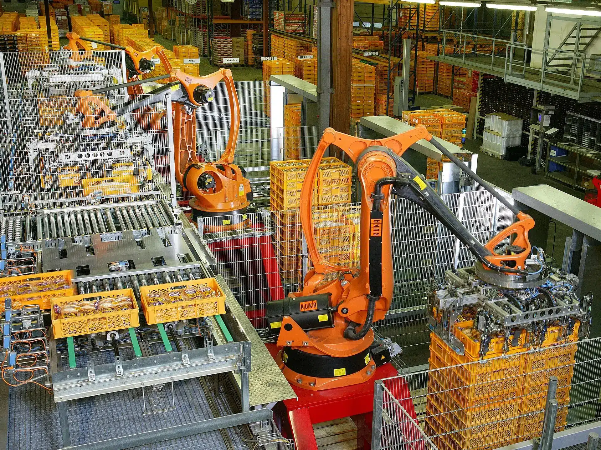
Explore real-world applications of robotics across warehouses, factories, farms, and aerospace, and learn how physical AI and high-quality data power intelligent robots.
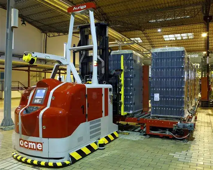
Discover how warehouse robots learn from teleoperation data to handle real-world warehouse automation