Scientific discoveries and innovations often go hand in hand with advancements in technology, especially when it comes to tools that help with making observations. One such game-changing tool is drones. Drones, especially aerial drones, are widely used in different types of surveys to gather important data for research and analysis.
Now, with the help of AI, these drones are becoming completely autonomous and more accurate than ever before. For example, they can be used to track geological changes like landslides and erosion, assess geological hazards, manage water resources, and create detailed geological maps. These capabilities help scientists keep up with the latest changes in the environment and improve our understanding of the planet.
In fact, AI automation using aerial drones is making surveying and mapping faster. Using sensors like LiDAR and thermal imaging has also increased these AI drones’ ability to collect high-precision data. They can do so quickly while reducing labor costs and human errors. When combined with real-time processing methods, it opens up the possibility of various applications in industries like mining, construction, and agriculture.
As a result, we are seeing AI-enhanced drones being widely adopted for various tasks like inspections, mapping, and monitoring. In line with this, the global drone market size is predicted to grow to about $260.5 billion by 2030.
In this article, we’ll take a closer look at how AI drones are used across various industries, from environmental monitoring to mining.
Earth’s surface is full of surprises like natural resources and hidden hazards. When it comes to uncovering these surprises, geological surveys are crucial. They provide essential data for economic development, infrastructure planning, and environmental protection.
Aerial AI drones can improve the mapping and route planning of areas with exploration or development potential by making the process more accurate, efficient, and adaptable. They can analyze geospatial data in real time, automatically choosing the best flight paths and adjusting to terrain, weather, and obstacles. It eliminates the need for a human to control the drone.
These drones can be used to take both vertical and angled shots to create precise 3D models of challenging terrains that manual surveying can’t achieve. Some of them can even autonomously reach remote or hazardous areas, such as rugged landscapes, dense forests, or dangerous sites.
A great showcase of using AI drones in land surveying is a project by Norwegian People’s Aid (NPA) in Ukraine. Instead of relying only on manual inspections, NPA uses these areial drones to scan hazardous areas (conflict zones in Ukraine) remotely. Their AI platform then generates high-resolution maps and uses GPS (Global Positioning System) data to highlight areas requiring further investigation for materials that could be a threat.
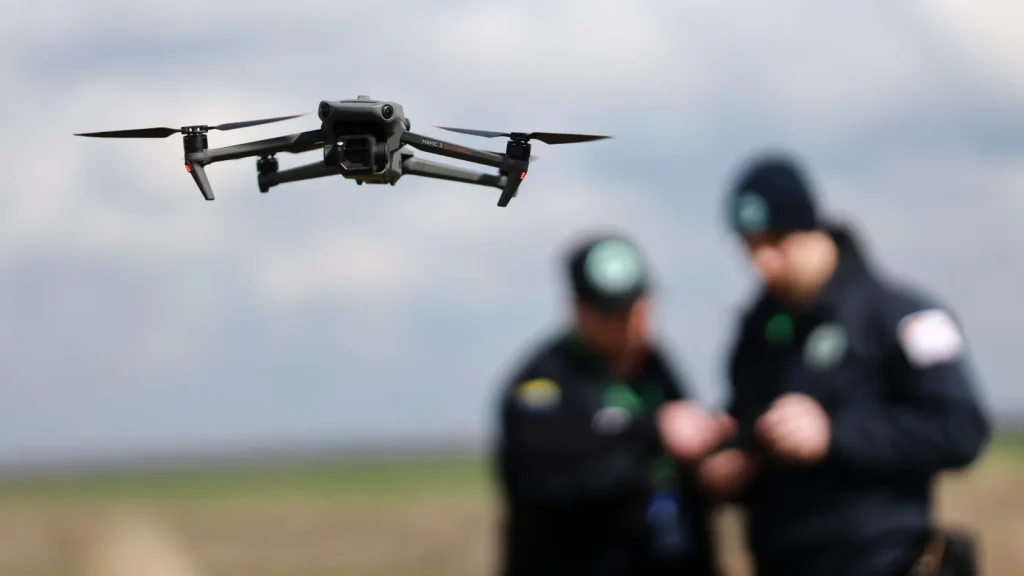
Norwegian People’s Aid officials using AI drones for land surveys. (Source)
Integrating drones with AI makes monitoring the environment faster, safer, and more precise. Drones can capture high-resolution images, collect data quickly, and reach difficult terrains with minimal environmental impact.
They can also be integrated with computer vision models to analyze images to classify different land types, such as forests, grasslands, and wetlands. This helps developers determine if a site is suitable for a project while following environmental guidelines. It is especially useful when it comes to monitoring issues like deforestation. By comparing and analysing data from these AI drones to old satellite images of forests, researchers can process the extent of deforestation. Interestingly, researchers are doing this to monitor the Amazon rainforest.
For instance, researchers from ETH Zurich are using AI drones to monitor unsustainable land use in the Amazon forest. By comparing current data with historical data, they can precisely identify how much forest areas have changed or disappeared over time. By using sensors like LiDAR point cloud, it is also possible to identify and monitor individual trees for detailed analysis.
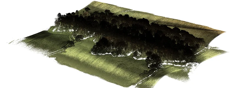
An example of a LiDAR point cloud image of trees taken by AI aerial drones. (Source)
Search and rescue (SAR) missions are vital for finding and helping people in distress. Traditionally, these operations used human teams and basic search methods, which could take a lot of time, especially in remote areas and rugged terrains. However, AI drones make SAR efforts and searches a lot faster.
Using machine learning techniques like reinforcement learning, these drones can adjust their search strategies in real time based on different conditions, improving their ability to locate people in distress. They can also operate in a fleet and share their experiences through a central database. Like a team of well-trained rescue dogs, these AI drones work together, learning from each other and adapting their search patterns to find people in need quickly and efficiently.
An interesting example of search and rescue drones being used for a mission was in China. To improve earthquake response and search for survivors, China deployed AI drones equipped with advanced cameras and sensors.
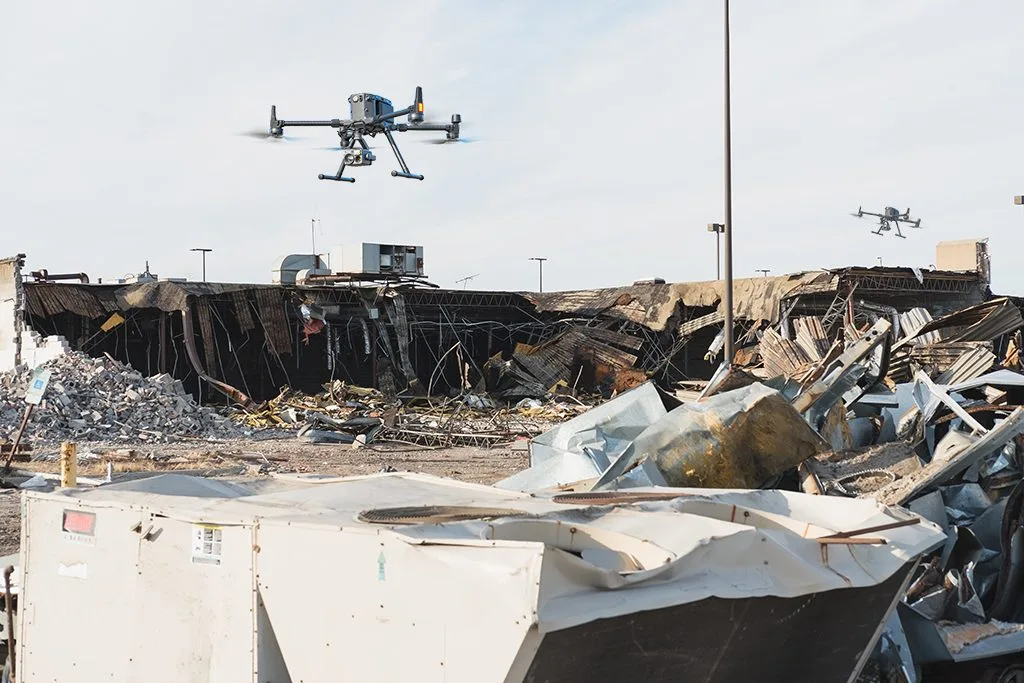
AI drones flying over a disaster-stricken area. (Source)
After a quake, these drones take off in hour-long intervals and cover two square miles per trip. Specifically, they are thermal imaging drones that can scan collapsed buildings and debris using onboard infrared and multispectral sensors. The drones then send real-time data and images to monitoring centers, helping rescue teams to identify and reach those in need quickly.
Thermal imaging drones integrated with AI can help detect hidden cracks, weak spots, and mineral deposits in buildings and the ground. Thermal imaging is the process of using infrared sensors to detect heat emissions from objects. With such sensors, these drones can find out the temperature differences that reveal underground faults or structural damage. Then, AI algorithms can analyze the data to identify risks early. This can improve safety and prevent costly failures in energy extraction and industrial settings.
These drones are also a great option for monitoring energy extraction equipment. Oil and gas extraction companies use thermal imaging drones or unmanned aircraft systems (UAS) along with AI to constantly collect data and keep an eye on their assets. If any defects or leaks are found, maintenance teams can be automatically notified through alerts.
For example, AI drones are monitoring pipelines in California’s San Joaquin Valley. The valley contains pipelines and infrastructure across a 4,300-square-mile area. Since AI drones can cover large areas with high precision for extended periods of time, they are perfect for the real-time monitoring of these facilities and assets.
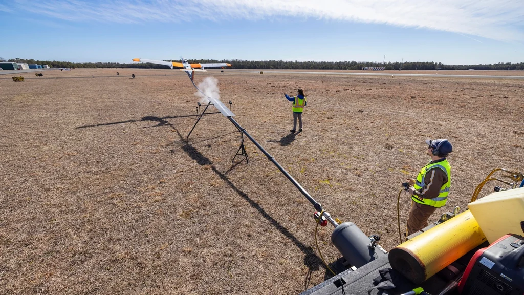
An AI drone (UAS) being launched for pipeline monitoring. (Source)
Mineral exploration and mining have been a key part of human civilization for years. From the coal that became our earliest source of fuel to the rare metals used in today’s computer chips, mining makes it all happen. Over the years, we have used many methods and technologies to make mining more productive and safer. AI is the latest among those lines of technologies. AI drones are changing the way mineral exploration and mining are done by providing accurate data and improving safety.
AI drones are being used in mines to survey large areas, monitor equipment, and assess environmental conditions. With advanced sensors, they can help identify geological features and locate potential mineral deposits as well. They also reduce risks for miners by handling dangerous tasks and delivering real-time data to operators. In some instances, these AI drones are also used inside mine tunnels.
A fascinating case study of this is AI drones being used to map the tunnels of an old gold mine in Nevada. Since the gold mine was shut down for over 25 years, workers were unsure about the conditions inside the mine. Since safety was the top priority before reopening these old mines, the team required highly detailed maps of the mines. Manually inspecting these old mine shafts wasn’t safe because the walls of the tunnels could be unstable.
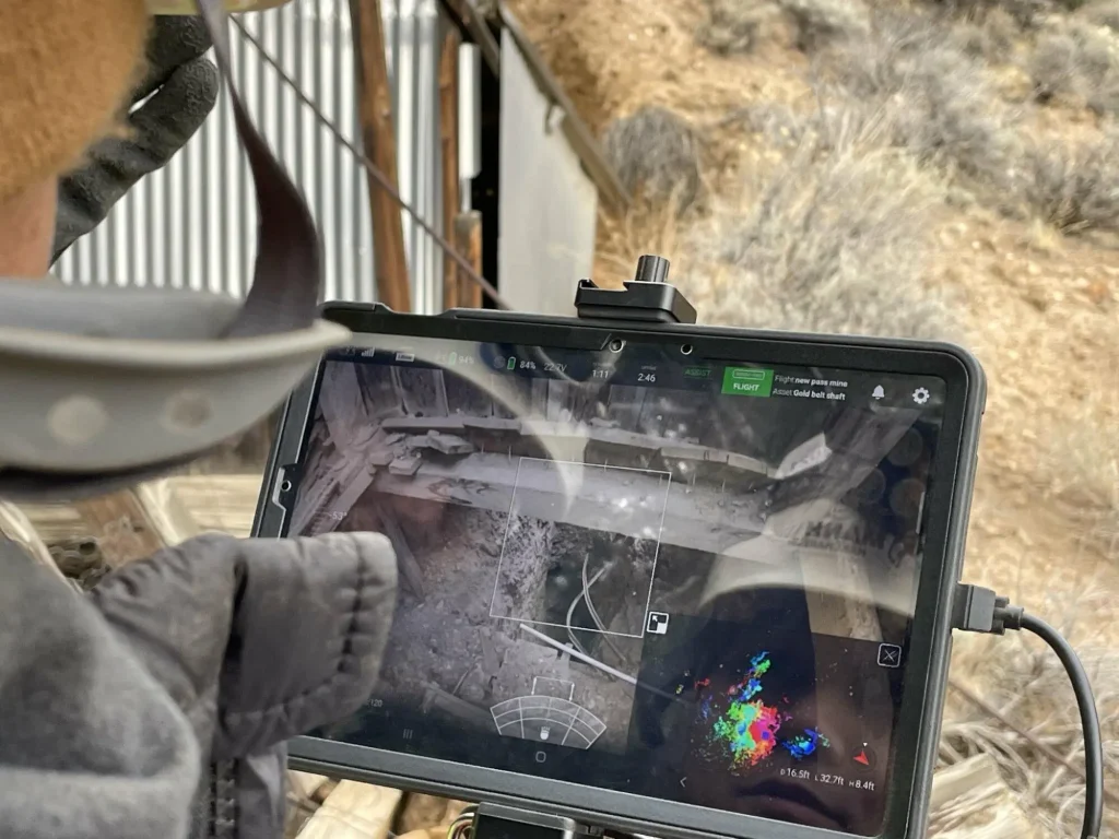
An operator viewing the AI drone feed from inside an old mine. (Source)
The AI drones helped with creating detailed 3D maps of the mine shafts. These drones were equipped with LiDAR point cloud technology to gather important data for planning and safety checks.
Now that we’ve explored the potential of AI drones with respect to collecting valuable data for various applications across a number of industries, let’s take a closer look at some of the related future trends:
While AI drones are opening doors for many trends in the coming future, it is also important that we consider some of the challenges associated with them:
AI drones are here to stay. They are making data collection faster, safer, and more accurate by using smart technology and advanced sensors. Industries like mining, farming, and construction are already using these drones to create detailed maps and gather information in real time.
Even though there are some challenges, such as strict regulations, limited data, and security risks, AI and drone technology are improving quickly, and with the right expertise, these hurdles can be easily handled.
At Objectways, we provide accurate data labeling services to enhance AI model performance in applications like AI drones and many others. We can also help you build custom AI solutions for your unique business challenges.
Ready to take your AI project to the next level? Contact us today.


Learn why egocentric data is essential for training robots in real life, how it differs from normal video standards, and what it takes to capture...

Explore the latest teleoperated robots news in 2026, showing how human control enables safe real-world operation while advancing robot autonomy.