Most phones now have multiple cameras. The wide lens captures the whole room, the telephoto lens brings distant objects closer, and the macro lens reveals close-up details. They all take pictures, but each one gives you a different view.
Lidar works in a similar way. Light detection and ranging, or lidar, is a family of sensors that use laser light to measure distance. Different types scan their surroundings in different ways, which affects how much they can see, how they handle movement, and how far they can measure.
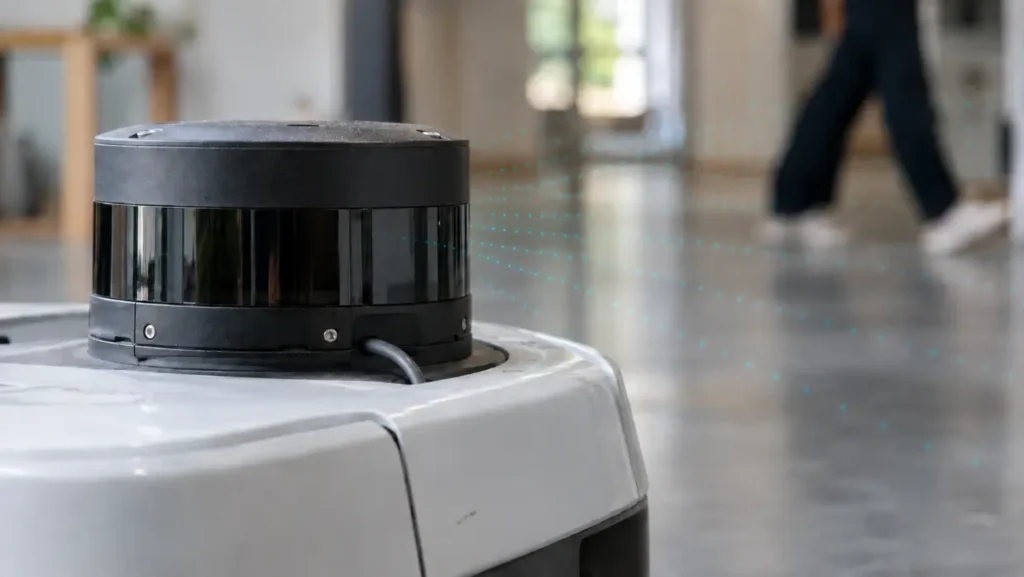
You can see this difference even in robot vacuums. Narwal’s Freo 20 and Freo 20 Edge were launched together with the same suction power and mopping system, but they sense their surroundings differently. The Freo 20 uses dual cameras to recognize objects around the home, while the Freo 20 Edge combines hidden lidar with structured light to build a 3D view of a room.
That difference becomes crucial as robots take on more complex tasks. A vacuum might use a spinning laser to map a room, while a humanoid robot could rely on a small lidar sensor on its head to judge the space around it. Another sensor might track how fast nearby objects are moving. All three carry the same label, but what they hand back to the robot looks nothing alike.
That’s why choosing the right type of lidar starts before a sensor ever goes onto a robot. The way it scans determines its blind spots, how it captures motion, how far it can measure, and ultimately, the kind of data the robot trains on. The right choice comes down to what the robot needs to see and how it will use that information.
In this article, we’ll look at the main types of lidar sensors, how they measure distance, and which robots each type suits. Let’s get started!
Before comparing different types of lidar sensors, let’s look at what happens when a sensor measures distance.
In mapping and geographic information systems (GIS), lidar types usually refer to airborne or terrestrial systems. On a robot, what makes a difference is how the sensor itself works, starting with how it measures distance.
Every lidar sensor sends laser light out toward the world and measures the returning signal. The difference lies in how it uses that signal.
The more common approach is time-of-flight (ToF) lidar. The sensor sends short pulses of laser light and measures how long each one takes to return, giving the robot a point in 3D space for every return. It shows where a surface is, but not how fast it’s moving.
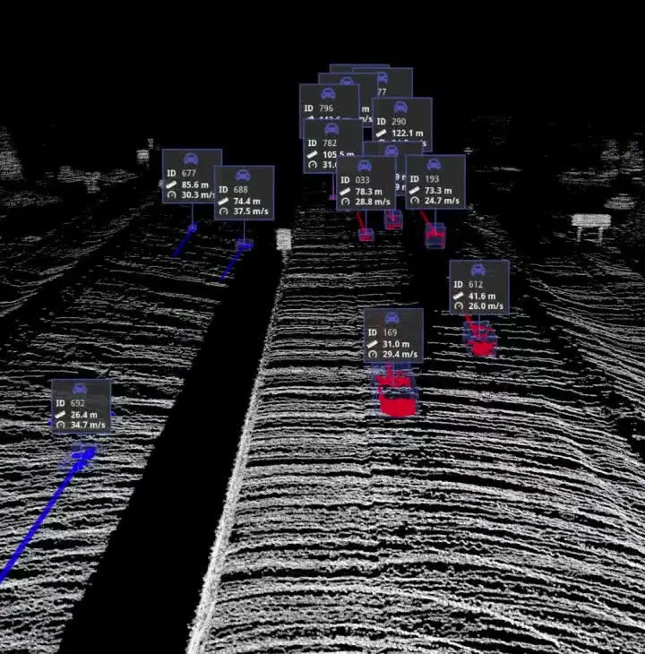
Frequency-modulated continuous-wave (FMCW) lidar takes a different approach. It sends a continuous laser beam while changing its frequency over time, then compares the returning signal with the original. That gives both the distance to a point and how quickly it’s moving toward or away from the sensor, which is why these are often called 4D lidar. It also helps the sensor recognize its own signal, so it’s less likely to be confused by sunlight or nearby lidar.
That capability is now making its way into smaller sensors designed for robots. For instance, Aeva Omni is a short-range 4D lidar built for environments where people and equipment can move quickly. It can scan the area around a robot in a full 360-degree view, detecting objects up to 80 meters away and tracking how fast each one is moving.
So far, we’ve seen how a lidar sensor turns returning light into distance. Next, we’ll see how much of the space around a robot it can actually see. That is essential because a robot can only detect what its sensor can see. For example, a 2D lidar scanning one level of a room can miss obstacles that sit higher or lower.
Here’s a closer look at the three main ways lidar can cover a robot’s surroundings:
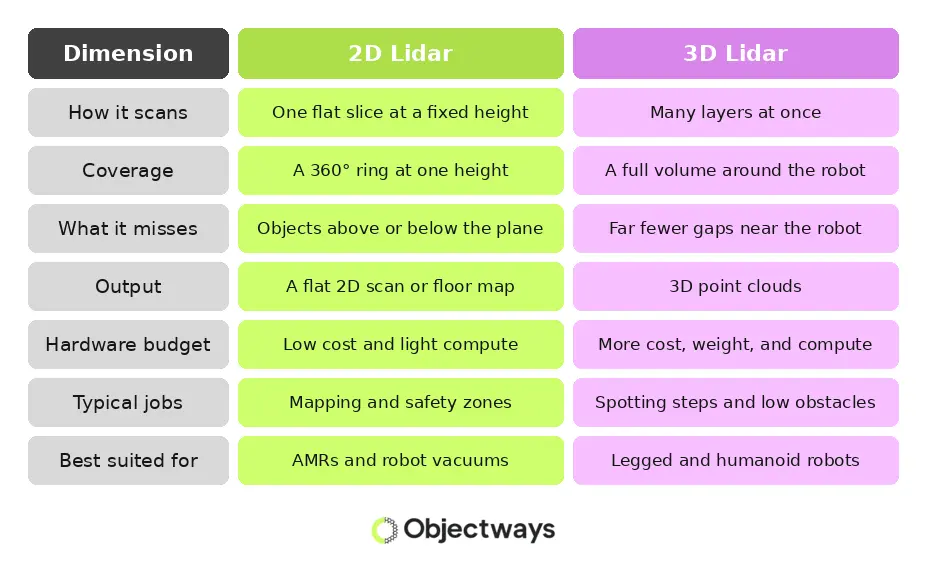
The difference becomes clearer when a robot has to navigate a real environment. In a recent navigation study, a mobile robot relying on 2D LiDAR reached its goal in just 37% of runs, with most failures caused by collisions with low obstacles outside its scan plane.
A wider view can also give a robot more localization information. Supermarket shelf rows can look nearly identical at floor level. One commercial cleaning robot uses the upper part of its 3D scan to localize against shelf tops and the ceiling, while the lower part handles obstacle avoidance.
That doesn’t make 3D lidar the obvious choice for every robot. In flat, structured spaces, 2D lidar can be cheaper, lighter, and easier to process. When a robot has to work around shelves, stairs, or obstacles at different heights, the extra coverage from 3D lidar gives it more information.
Lidar sensors also differ in how they move a laser around a space. This matters when the sensor is mounted on a robot that spends hours walking, rolling, and turning, because the scan method can affect both the hardware and the data it produces.
A mechanical spinning lidar sensor is a good example. The laser and receiver sit on a rotating core, giving the robot a 360-degree view as the sensor spins. That wide coverage comes with moving parts, though, which can wear out over time.
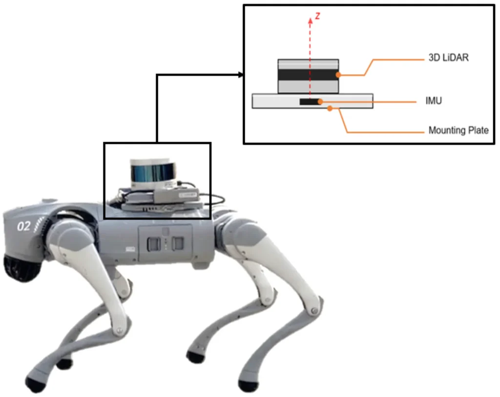
The robot’s movement can affect the scan too. In a study on a quadruped robot, researchers found that a spinning lidar captures different parts of a scene at slightly different moments. A small jolt or tilt as the robot takes a step can shift those points and distort the resulting scan. The researchers noted that these errors are more likely on legged robots than on wheeled ones.
Micro-electro-mechanical systems (MEMS) lidar works differently. Rather than rotating the whole sensor, it uses a tiny mirror to steer the laser. This makes the unit smaller while reducing the number of moving parts.
Solid-state lidar goes one step further by removing moving parts altogether, and these sensors are already shipping for robots. RoboSense’s E1R, for example, scans electronically with nothing moving inside and has passed more than 60 reliability tests, including vibration shocks up to 50G and dust and water protection ratings. Looking ahead, optical phased arrays aim to steer laser beams directly on a chip.
For a robot that has to work day after day, these design choices affect more than the scan. They also shape how well a sensor handles vibration and dust, how often it may need replacing, and how easy it is to maintain across a fleet.
Most lidar sensors build a scene one sweep or one beam at a time. Flash lidar works differently. It lights up its entire field of view in a single burst and captures the whole scene at once. That design keeps the hardware simple, but it also changes how far the sensor can see.
Let’s look at what that trade-off means on a robot:
Capturing a whole view at once doesn’t require a large sensor either. Some are small and cheap enough to scatter across a robot’s body. For instance, in a recent study, researchers fitted a robot arm with tiny lidar sensors weighing about a gram each, and the arm used them alone, without a camera, to locate a crate and a deer statue nearby.
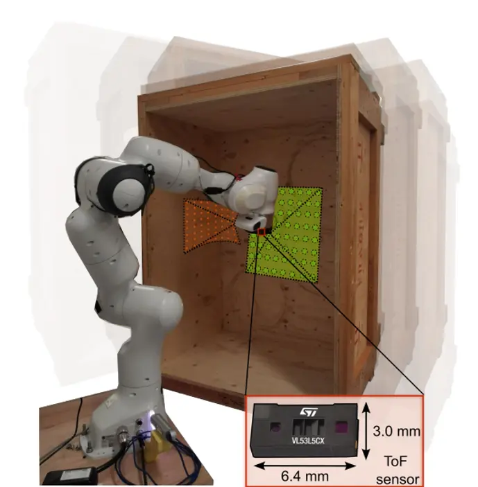
That shorter range also reduces detail at greater distances. As an object moves farther away, each depth reading gives the robot less information, so these tiny sensors aren’t well suited to mapping an entire room. For close-up tasks such as reaching for an object or lining up with a dock, seeing the nearby space clearly can be more useful than detecting objects at a greater distance.
Lidar and ToF cameras both use light to measure depth, but they do it in different ways. Most lidar sends out a light pulse and measures how long it takes to return. A ToF camera sends light that pulses on and off in a repeating pattern, then compares the timing of the returning wave with the outgoing one. That offset, known as a phase shift, tells the camera how far the light traveled.
This approach works well for short-range 3D sensing, and ToF cameras can produce detailed depth maps. As the distance increases, though, their accuracy can drop, and fast-moving objects can create artifacts in the depth image. Surfaces can make things harder too.
That doesn’t mean a robot has to choose between visual detail and depth. Some robots combine RGB and lidar depth in a single device. These lidar cameras give the robot a regular image alongside 3D measurements, so it can recognize an object while also working out where it sits in space.
For example, the Fourier GR1 used this approach during teleoperation. A lidar camera mounted on the robot’s head handled both tasks while streaming its view back to the operator. The trade-off was bandwidth, since the sensor needed enough onboard computing power to avoid lag.
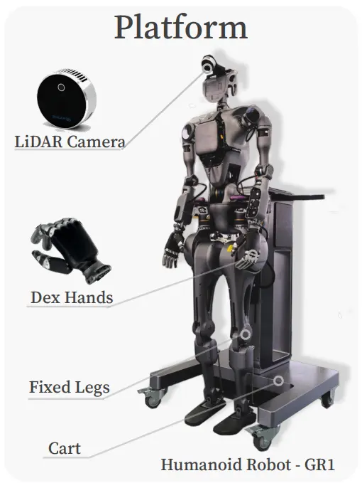
Thanks to using both types of sensors, the robot gets both streams from the same place. The image and depth data come from the same viewpoint at the same moment, so it doesn’t have to work out how a separate camera and lidar line up with each other.
Lidar sensors differ in how much of a robot’s surroundings they can see and the kind of information they capture. That choice is key when planning data collection.
The sensors used during training need to match the setup the robot will use later. If the hardware changes after thousands of demonstrations have been recorded, the data may need to be collected again.
Here’s an overview of which lidar setup suits different robot tasks:
The choice also affects the training data. For instance, a 2D scan, a spinning 3D sweep, and a flash frame each capture the surroundings differently. That changes the coverage, timing, and amount of detail in each recording. Those streams then need to line up with camera feeds and joint data so each demonstration reflects what the robot will see during deployment.
For teams looking for extra support, a data partner can help with data collection and preparation. At Objectways, we provide depth data collection matched to a robot’s sensor setup, including lidar and depth cameras. We also provide point cloud annotation to turn those recordings into training data ready for model development.
A lidar sensor does more than help a robot measure distance. The type a team chooses decides how far the robot can see, where its blind spots sit, and whether it can tell a moving person from a still shelf. Those same traits end up in every point cloud the robot records.
That’s why sensor selection and data planning belong in the same conversation. A dataset captured with a spinning 3D sweep won’t look like one captured with a flash frame or a single scan plane, and a robot trained on one may not perform the same way with the other. Settling the sensor question first keeps training data aligned with the robot that will actually use it.
Looking for depth data built around your robot’s sensor setup? Reach out to Objectways to learn more about our data collection and annotation services.
A lidar sensor measures how far away surfaces are by sending out laser light and reading what comes back. By repeating this thousands of times per second, it builds a 3D point cloud that shows the shape and position of everything around it.

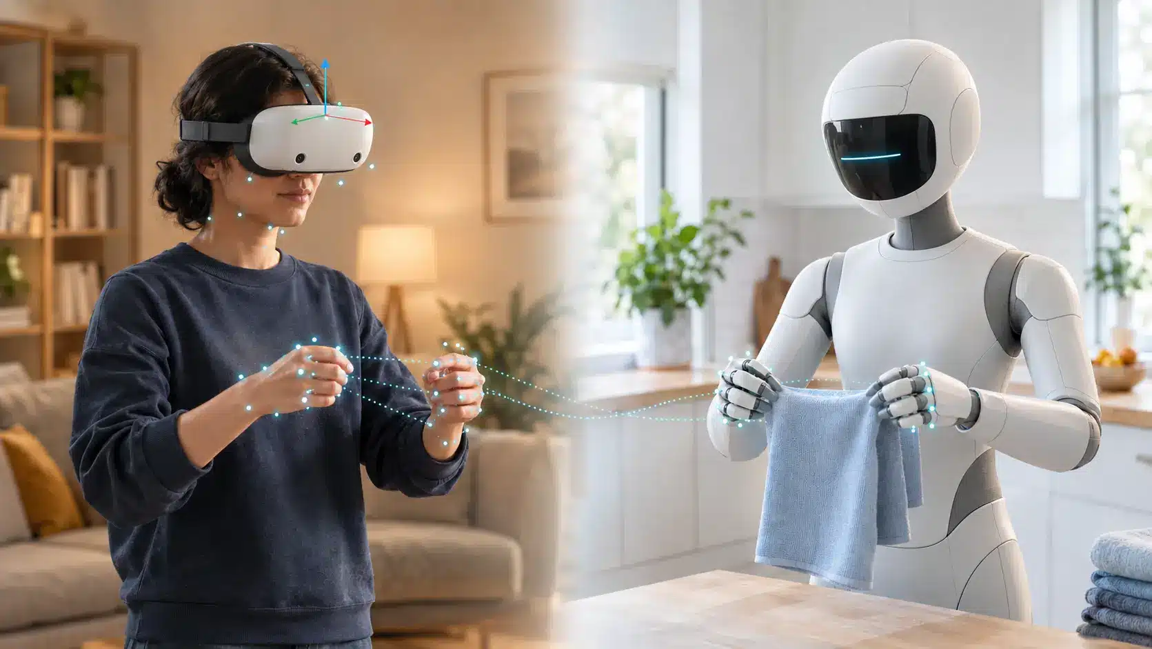
See how SLAM VR tracking works inside a headset, where it fails, and why a drifting head pose weakens egocentric and teleoperation data.
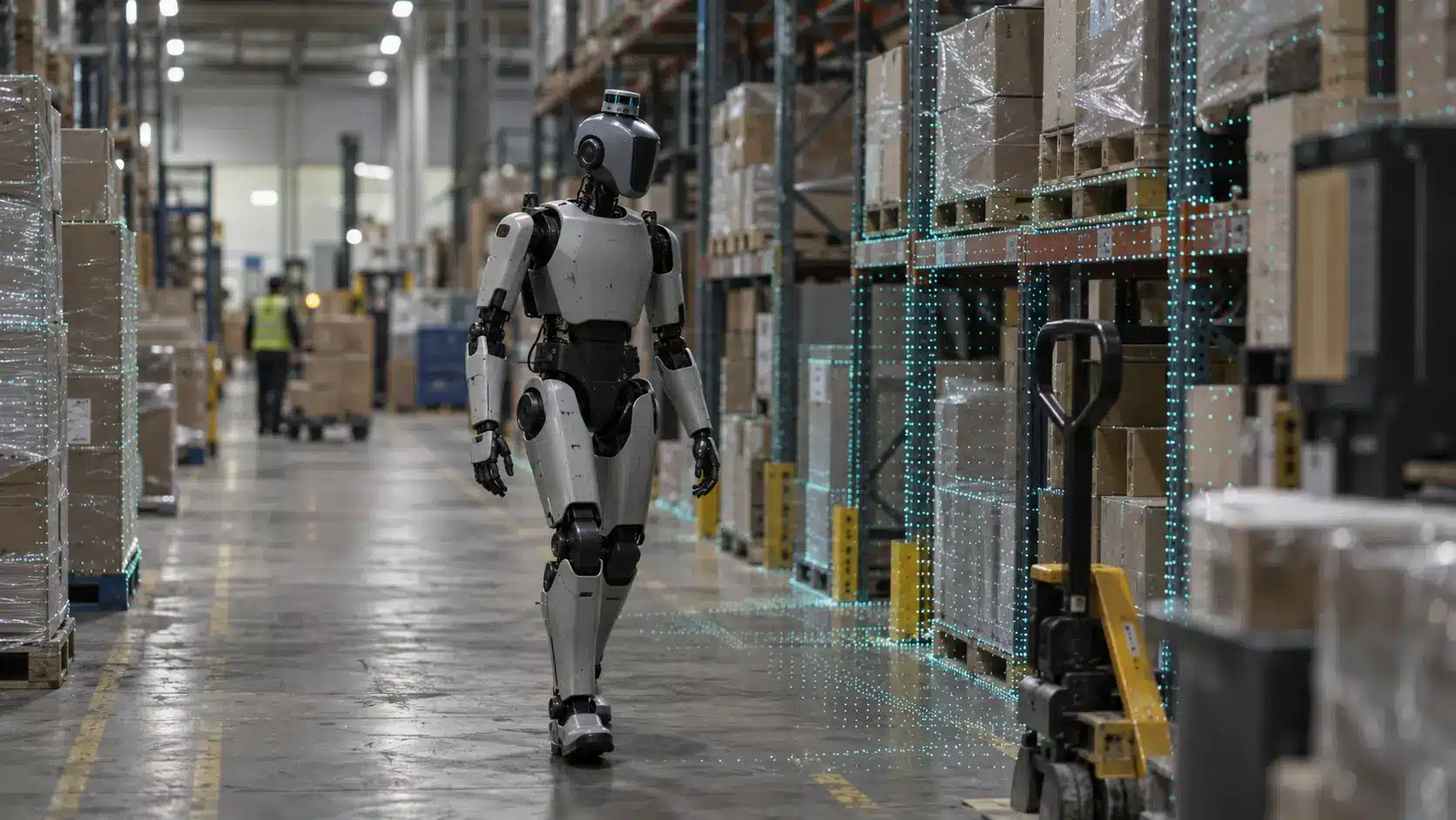
Learn why some humanoids use lidar robotics while others rely on cameras, how each sensor compares, and what that choice means for robot training data.